Enjoy the warmth while it lasts. A powerful cold front is set to sweep through the region Sunday night, bringing a threat of severe weather followed by a bitter reality check for the final days of December.
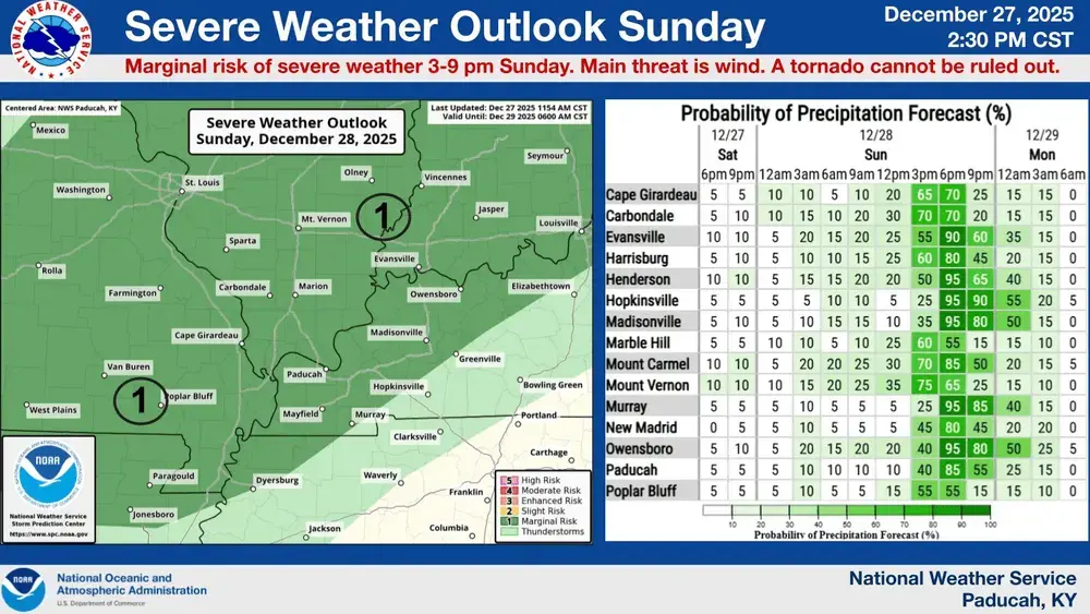
The Storm Prediction Center has placed our area under a Marginal Risk for severe storms, with the primary concerns being damaging winds and the outside chance of a tornado. Hopkinsville, Madisonville, or Murray areas will need to keep an eye on the sky between 3:00 PM and Midnight. It will be a windy day regardless, with southwest gusts hitting 40 mph before shifting to the northwest Sunday evening as the front pushes through.
The Christmas thaw ends abruptly as we head into the workweek. Highs will struggle to hit 40 degrees on Monday and will likely stay near the freezing mark on Tuesday. Overnight lows will bottom out between 19 and 25 degrees through Wednesday night, but the wind will make it feel even colder. Wind chills could be as low as 10 to 15 degrees on Monday and Tuesday.