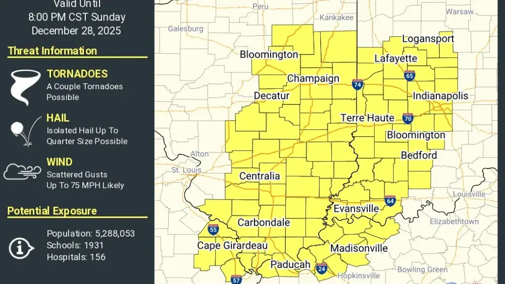
A tornado watch is in effect until 8 Sunday evening for Hopkins, Caldwell, and Lyon Counties and all counties to the north and west.
The National Weather Service issued the watch shortly before 3:00 Sunday afternoon after noting in their afternoon weather briefing the severe risk has increased. Trigg, Christian, and Todd Counties in the immediate listening area are not included in the tornado watch at this time.
The National Weather Service has issued a Wind Advisory for all of Western Kentucky from 6 this evening until 6 Monday morning, with the region under a marginal risk for severe thunderstorms.
Forecasters say a few thunderstorms are possible this evening. Isolated strong to severe storms are possible with the main threat damaging wind gusts or brief tornadoes.
Wind gusts could reach 40 miles per hour this afternoon and tonight.
As storms and severe threat move out of the region this evening, the National Weather Service says colder temperatures will blanket the area Monday and Tuesday. With the combination of lows in the low 20s to upper teens Monday and Tuesday morning the wind chills could dip into the single digits.