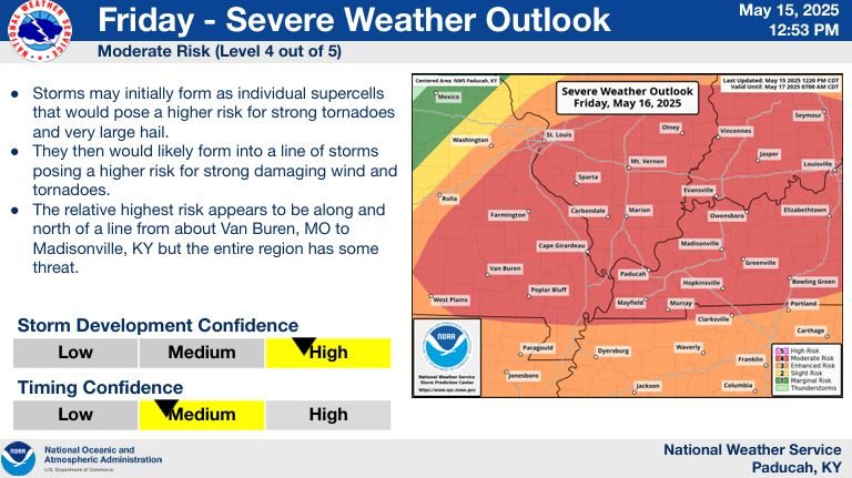
While Thursday night’s weather forecast in the News Edge listening area does remain unstable, National Weather Service officials from Paducah have turned their full attention to Friday — where all of western Kentucky has now been moved into a Moderate (4 of 5) chance for severe weather.
Keith Cooley, senior forecaster in Paducah, said a Slight risk (2 of 5) moves through all of the Quad State region tonight, with baseball-sized hail, sustained 60 mph winds and isolated tornadoes possible.
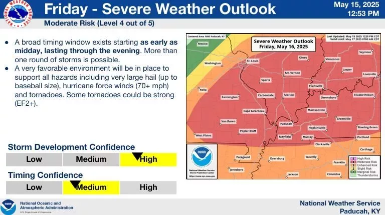
By Friday, Cooley noted that a major front will arrive by 1 PM in southeast Missouri and be in Graves County by 6 PM — bringing with it a “favorable environment” for baseball-sized hail, hurricane-force winds above 70 mph and tornadoes EF2 or greater in strength.
Cooley noted that there are more than 4,000 joules of instability in the atmosphere, an “off-the-charts” kind of instability for this time of year.
Tornadoes, he added, could potentially develop in the supercells ahead of the front, as well as within the front as it moves through the area.
Confidence of these storms, he said, are “high,” with timing confidence “medium.”
Cooley again reinforced why west Kentucky was upgraded to a Moderate threat for severe weather.
Forecasts seem much calmer through the weekend and going into Monday, before next Tuesday could bring another bout of severe weather.
FULL CONFERENCE: